Get bike directions with GO
Looking for safe, fast, easy to follow biking directions to your home, gym, or work? Transit now supports turn-by-turn directions for bike trips, using GO!
Note: At the moment, GO bike only supports personal bikes, not bikeshare or e-bikes. Multimodal trips (bike + transit) are also currently unsupported.
Here's what this article covers:
- Plan a trip with GO bike
- Customize GO bike
- Turn-by-turn navigation with GO bike
- Features and directions
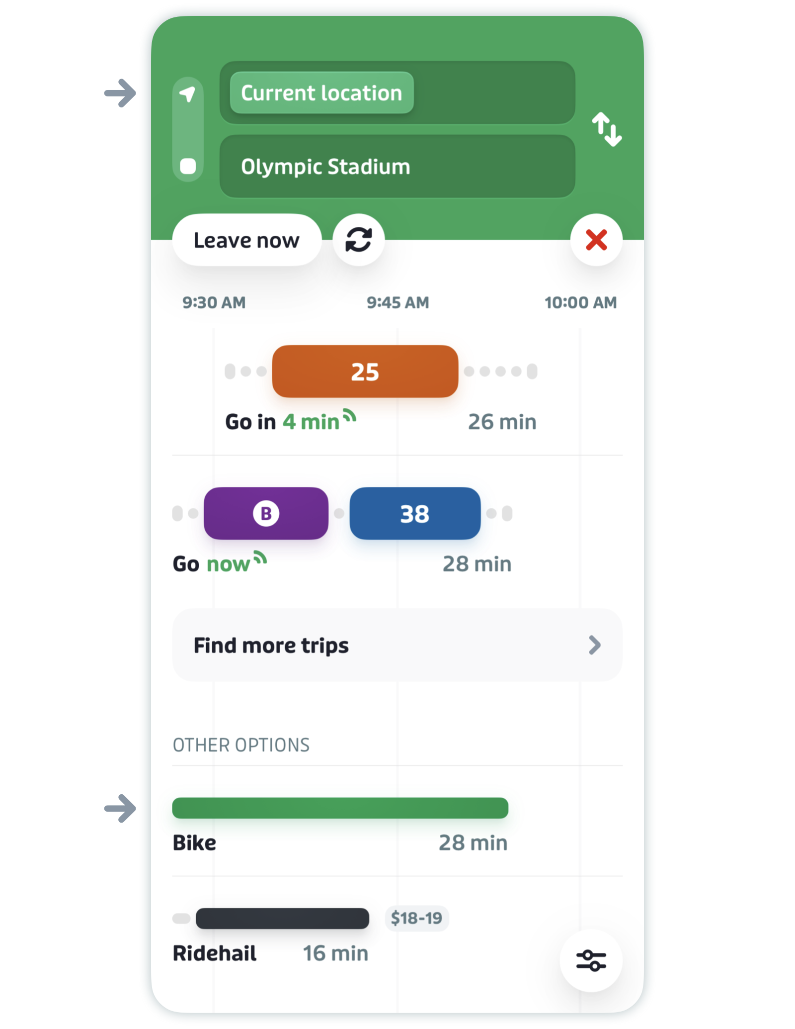
Plan a trip with GO bike
-
On the main screen, tap the search bar.

- Enter your destination. Here you can: type an address, select a point on the map, select a favorite location, or pull up an address from your phone's calendar or contacts.
- Tap the search result you want.
- Tap in the upper "Current location" field to change your starting point, if desired.
-
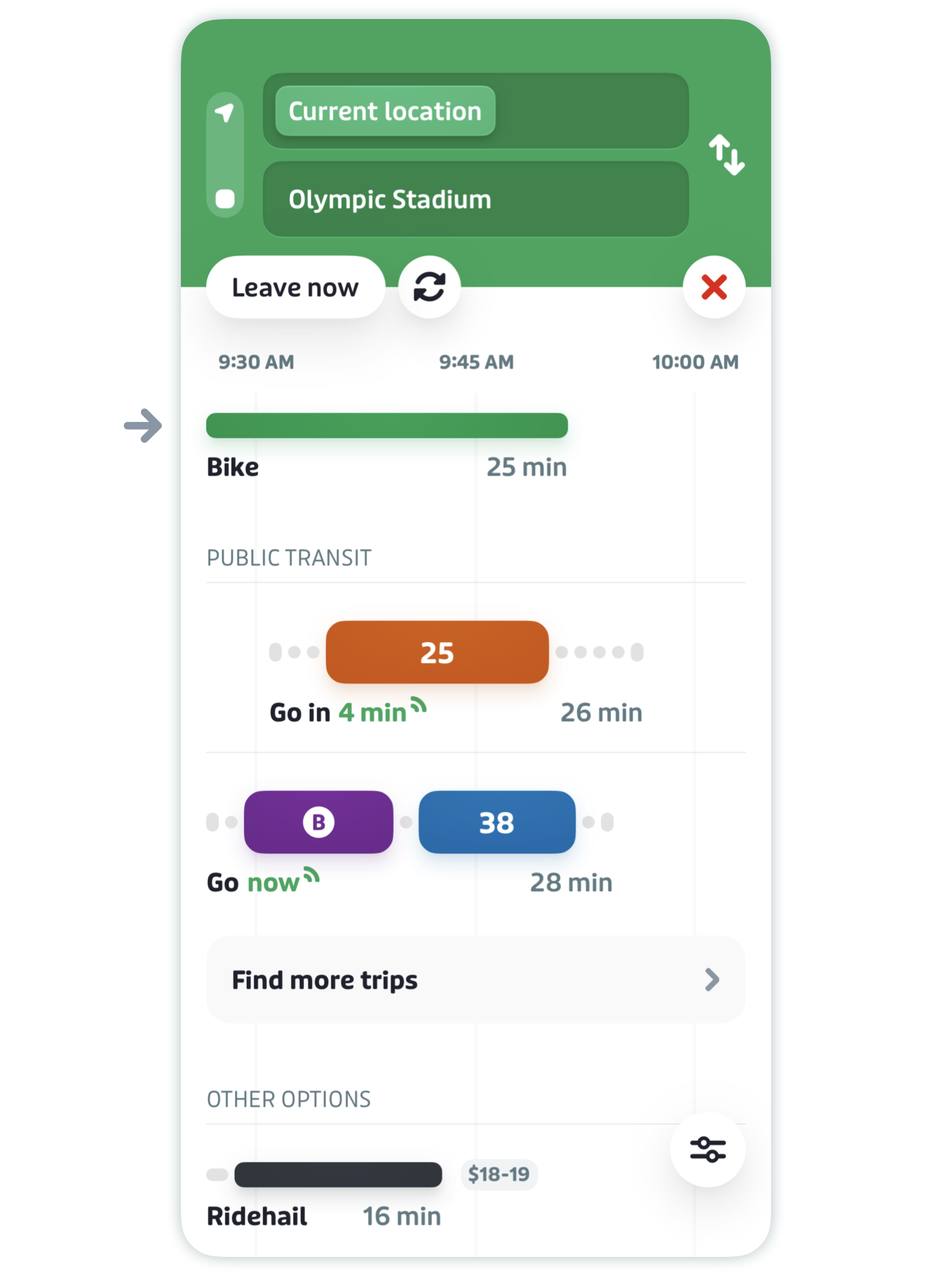
Scroll down and select "Bike" under "Other options".


Pro tip: If you want to plan a trip in advance, here’s how.
-
You’ll then see trip duration, arrival time, total distance, and the elevation for your trip in the summary section, along with a note about how protected (or safe) your trip is.
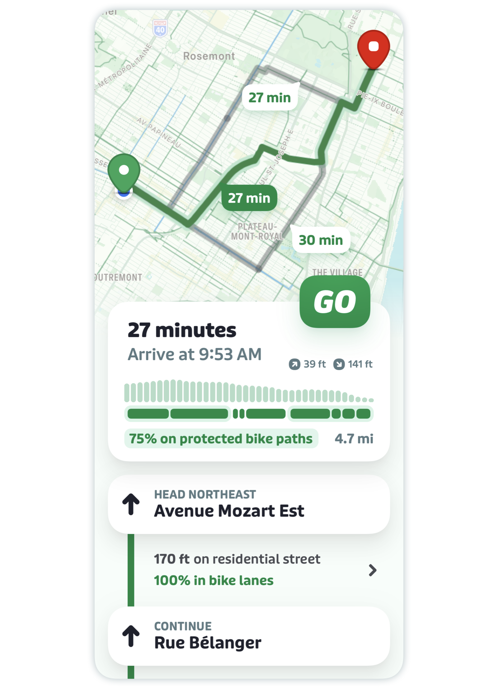

GO bike will also suggest alternative trips (in grey) which you can tap to select. Each trip will vary with respect to estimated arrival time, elevation, and protection level. You can see the differences in the summary section when you select a new trip.

-
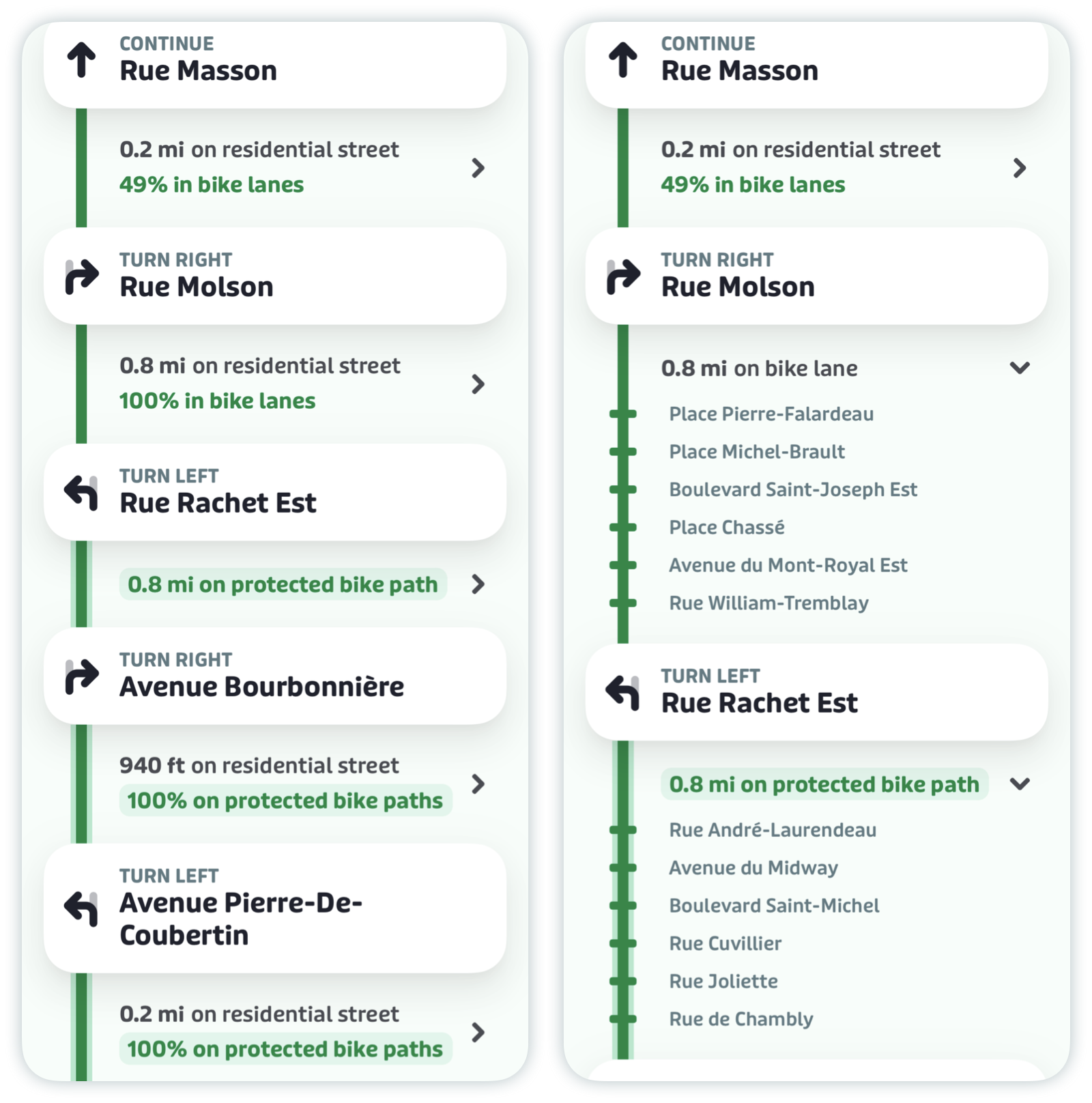
Scroll down to see your entire trip plan, plus each step of the directions, the distance between them and the path type (see below for more details). Tap the chevrons to reveal which cross streets to ride past to get to your next turn.

Customize GO bike
You can customize GO Bike in two ways:
- Prioritize biking results in the trip planner by adjusting your commuting preferences.
- Adjust your biking speed to get more accurate biking duration results.
Here's how:
-
Tap the gear icon at the top left of the main screen.
-
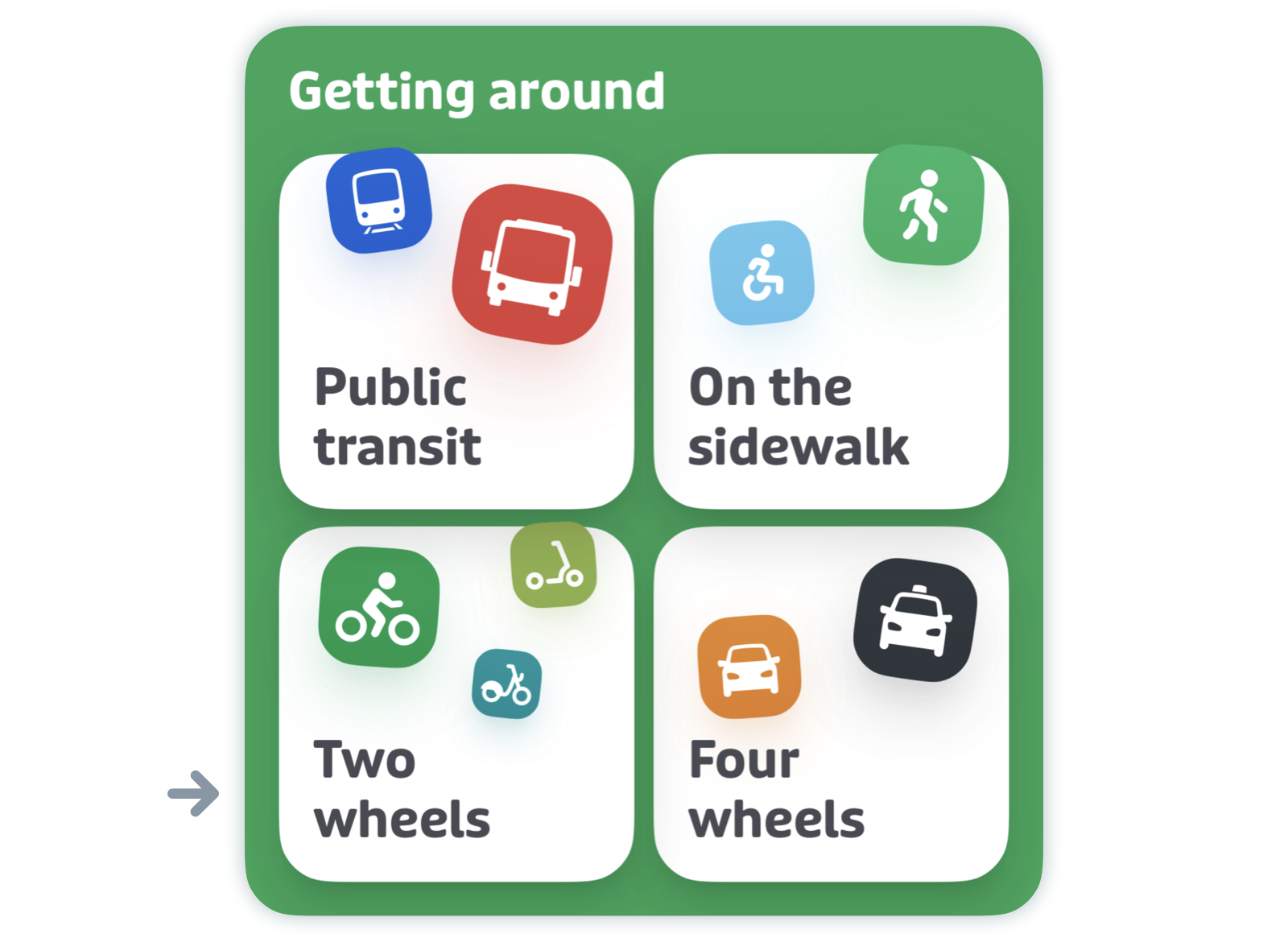
Scroll down to "Getting around" and tap "Two wheels".
-
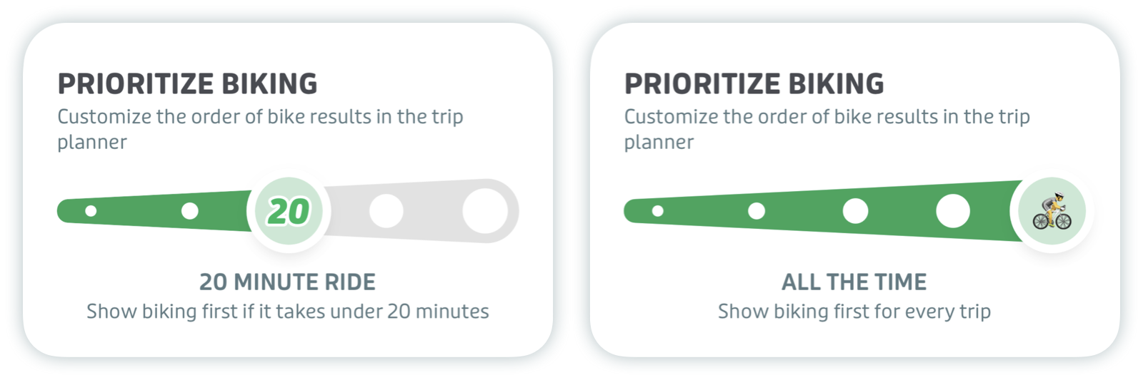
Here you'll be able to adjust the order of bike results in the trip planner and your biking speed. The settings below are the default ones.

-
The default priority option shows biking below transit in the trip planner. Adjust the slider to show biking options first for trips under 10, 20, or 30 minutes, or to always show biking options first.
-
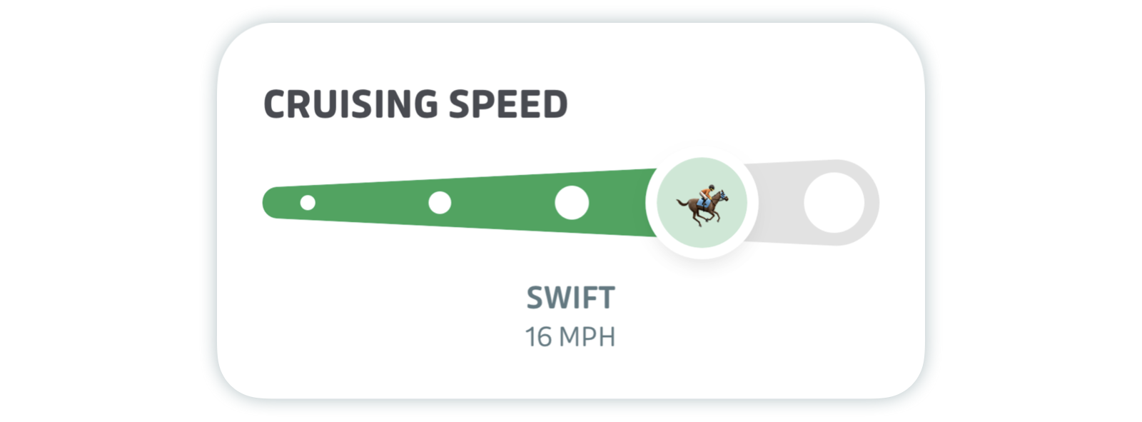
Then you can adjust your speed.
-
These changes will be reflected in the trip planner.
-
If a favorite location is within biking distance, a small bike icon will display next to the favorite icon in the search bar. Tap to instantly open a bike trip plan.


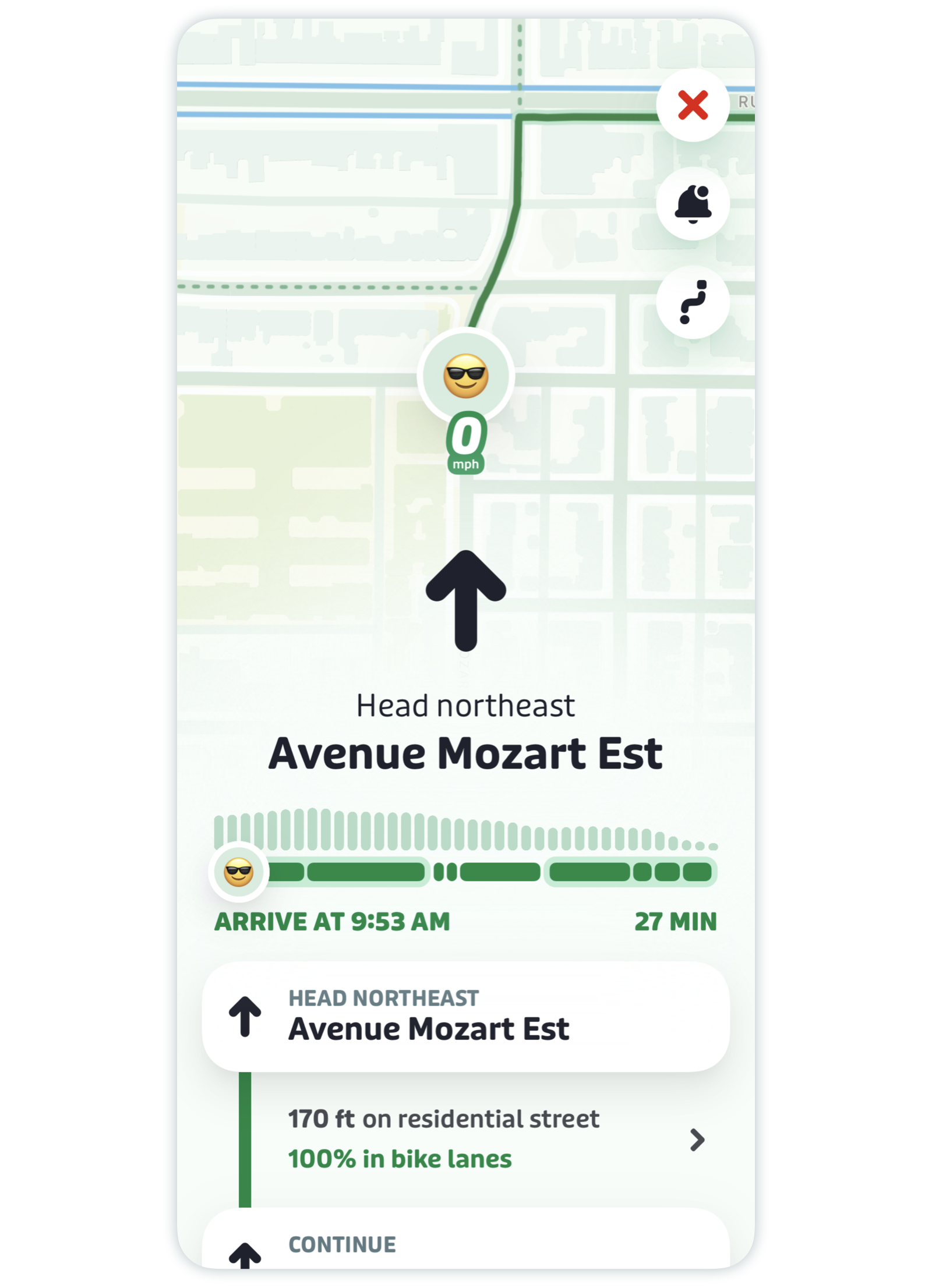
Turn-by-turn navigation with GO Bike
-
Tap GO to get the turn by turn directions to your destination, just like on the bus or train!
-
After tapping GO, you can swipe left on the large arrow to preview the directions for your trip.
Swipe right to go back, or tap on the small location arrow in the bottom left to return to your current direction.


Turn-by-turn audio notifications
To turn audio notifications on or off for your GO bike trip, simply tap the bell icon in the top right of the screen. You can also choose whether to speak notifications only when headphones are connected.
Note: If you’re using headphones, audio will be on by default.
Features and directions
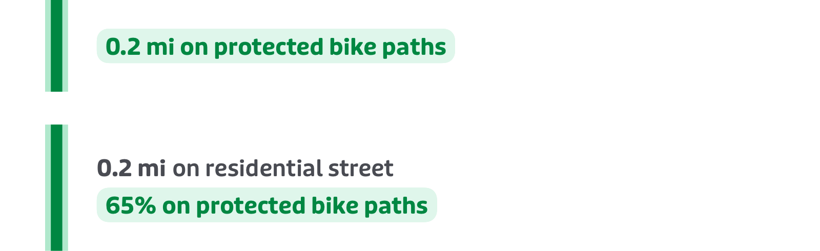
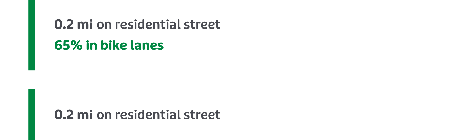
To understand the directions for your bike trip, each type of path is shown visually.
-
Green line with a neon outline: protected bike path
-
Green line: unprotected bike lane or residential street
-
Grey line with the yellow car warning symbol: busy road or highway


Questions or concerns? We’d love to hear your feedback. Tap or click here to find out how to get in touch.